
An open bird sanctuary off the end of the Whangaparāoa Peninsula, about 17 nautical miles from Westhaven. Takāhē, kōkako and tīeke, a historic lighthouse and a clear-water anchorage for a day stop. Here's how to plan your visit on a Daily boat.
Updated October 2026 · By the Daily Boats team
About 17 nautical miles from Westhaven, or about 5 from Gulf Harbour
About 50 minutes at 20 knots from Westhaven
Hobbs Beach on the west coast, in easterly or light, settled weather
Strong tidal current, shipping, and no fishing anywhere around the island
Walking tracks, the lighthouse, a visitor centre and toilets
Gulf Harbour, Motuora and Kawau Island
Tiritiri Matangi is a 220-hectare scientific reserve run as an open sanctuary by the Department of Conservation (DOC) with the Supporters of Tiritiri Matangi. Between 1984 and 1994, volunteers planted around 250,000 to 300,000 trees on what had been farmland. Today it's one of the best places in New Zealand to see rare native birds up close.
From Westhaven, head east past North Head, then north up the Rangitoto Channel, staying outside the buoyed shipping channel. Carry on north past Rangitoto and Whangaparāoa Head, then through the Tiritiri Channel, between the head and the island, to Hobbs Beach. It's about 17 nautical miles, so roughly 50 minutes at 20 knots. Into a head sea or wind against tide, allow longer: at 20 knots, sea state matters more than wind direction for comfort.
Big ships use the Rangitoto Channel, so keep a good lookout and listen on VHF. Expect a strong tidal stream through the Tiritiri Channel, especially at mid-tide. From Gulf Harbour it's only about 5 nautical miles to the island. Plan your fuel for the round trip and keep a reserve, especially if you're carrying on to Kawau.
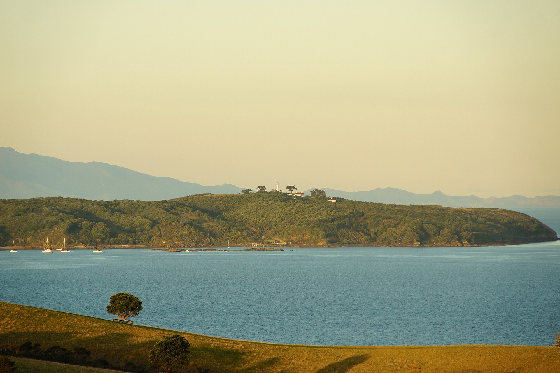
DOC says the best landing is at Hobbs Beach, a white-sand beach on the western side of the island with clear water for swimming and snorkelling. Boats usually anchor off it in about 7 metres.
Hobbs Beach is only comfortable in easterly winds or light, settled weather. It's open from the north-west round to the south-west, and local boaties say there's no fully sheltered anchorage anywhere around the island. Overnight it is often rolly, so treat Tiritiri as a day stop. Holding is reported to be patchy in places, so make sure the anchor is well set.
The wharf, just south of Hobbs Beach, is for the ferry and other permitted vessels. Don't tie up there. Anchor off and go ashore on Hobbs Beach instead. On busy summer days the bay can fill up with boats, so allow plenty of room for swing and tide. Keep to 5 knots within 200 metres of the shore.
Land on Hobbs Beach. It's about 600 metres along the coast to the wharf, then around a kilometre uphill to the visitor centre and lighthouse. Rangers live on the island.
There are toilets at the wharf, Hobbs Beach, the lighthouse and Spaghetti Junction. The visitor centre shop sells gifts and cold drinks only, and there are no rubbish bins, so bring food, water, sunhats and a rubbish bag, and take everything home.
DOC track times, one way:
10 minutes, wharf to Hobbs Beach. Rocky coast with little penguin nest boxes. Parts may be closed, with a low-tide detour, so check DOC's page before you go.
40 minutes, wharf to lighthouse. Gravel and boardwalk, and one of the best tracks for birds.
30–40 minutes, from the north end of Hobbs Beach to Ridge Road. Old pōhutukawa forest and lots of steps.
25 minutes along the island's spine to the lighthouse.
About 2 hours on the Ngāti Paoa, Northeast Bay and East Coast tracks. Some steep sections.
A Wattle Track loop takes about an hour, and a loop of the whole island 3–4 hours. Ferry visitors arrive Wednesday to Sunday and mostly head up the Wattle Track, so start on the Kawerau Track or Ridge Road for quieter birdwatching.
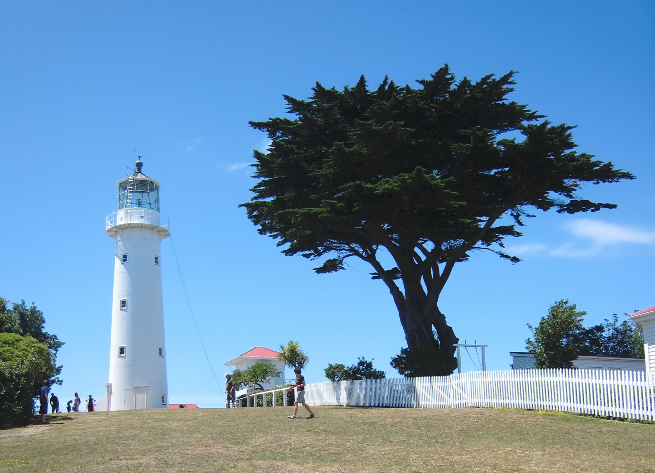
There's no camping on the island. DOC runs a small bunkhouse near the lighthouse with 15 bunks, which must be booked. If you arrive by your own boat, contact the rangers at least two days beforehand, and avoid Mondays and Tuesdays, when a ranger may not be available. Because the anchorage is often rolly overnight, plan to move on to a safer spot such as Gulf Harbour or Kawau for the night.
This is a longer trip than a typical Daily day out. Talk to the Daily team before planning it.
Kiore (Polynesian rats) were removed in 1993, and since then the island has been free of animal pests. Birds and other species brought here include tīeke (saddleback) in 1984, takāhē in 1991, toutouwai (North Island robin) in 1992, little spotted kiwi in 1993, hihi (stitchbird) in 1995, kōkako in 1997, and tuatara in 2003. The kiwi only come out at night, but takāhē often graze near the lighthouse.
The Hobbs family farmed the island from 1863 to 1971. The cast-iron lighthouse was first lit on 1 January 1865 and is the oldest lighthouse still operating in New Zealand.
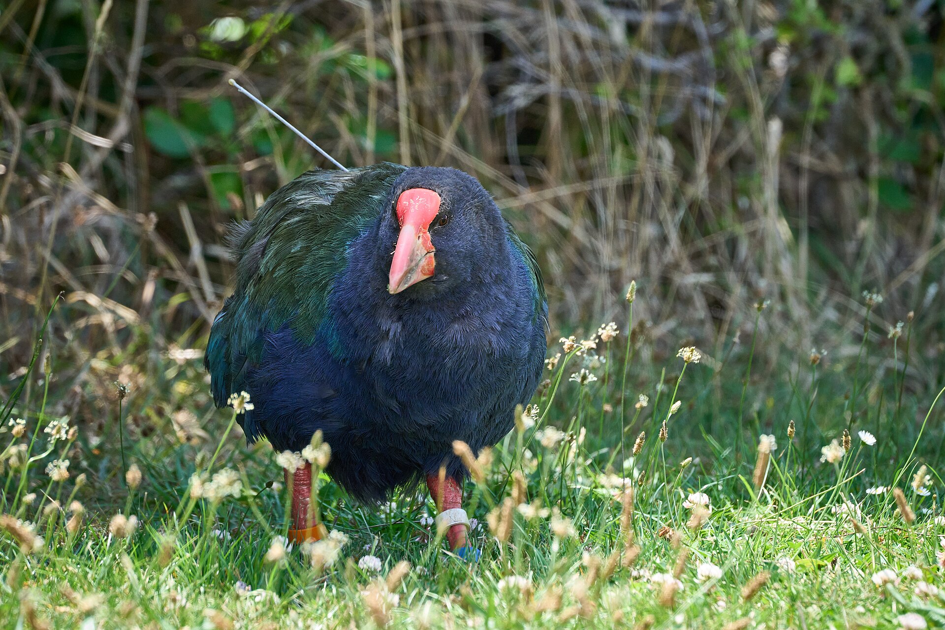
Since October 2025 the waters around Tiritiri Matangi have been a High Protection Area. No fishing of any kind, including crayfish and shellfish, and no dumping or discharging waste. Careful anchoring is still allowed.
Before you go, check the boat for rats, mice, ants and skinks, and keep bait or traps on board. Check and zip your bags, and clean soil and seeds off shoes. Never tie lines ashore. Report pests to 0800 DOC HOT (0800 362 468).
No fires, barbecues, camping or pets. Keep to the tracks, don't feed the birds or play bird calls, and don't take anything, including plants and rocks.
Check the MetService marine forecast for the Hauraki Gulf before you leave and again during the day. Log a trip report with Coastguard on the app, by calling *500 or on VHF. In an emergency, call Maritime Radio on VHF channel 16.
Early: check the forecast for an easterly or light winds, log your trip and head north.
Late morning: anchor off Hobbs Beach, go ashore and walk the Kawerau Track up to the lighthouse, returning by the Wattle Track.
Afternoon: a swim off the beach, then head home in daylight.
Saturday: cruise to Tiritiri for the day, then on to Kawau Island, about 11–13 miles, to anchor for the night.
Sunday: explore Kawau, then head home down the coast.
Daily bookings are full days, so a day trip to Tiritiri fits comfortably. See our guides to Kawau Island and Gulf Harbour Marina.
Daily members boat on Buccaneer 635 HT hardtops kept in their own berths at Westhaven, Pine Harbour and Gulf Harbour. Gulf Harbour, at the end of the Whangaparāoa Peninsula, is the closer base for Tiritiri. New members do a sea trial when they join, so you'll know the boat before your first day out.
Tiritiri is more exposed than the inner Gulf, so pick your weather. See how Daily works and more destinations, including Motuihe Island and Rākino Island.
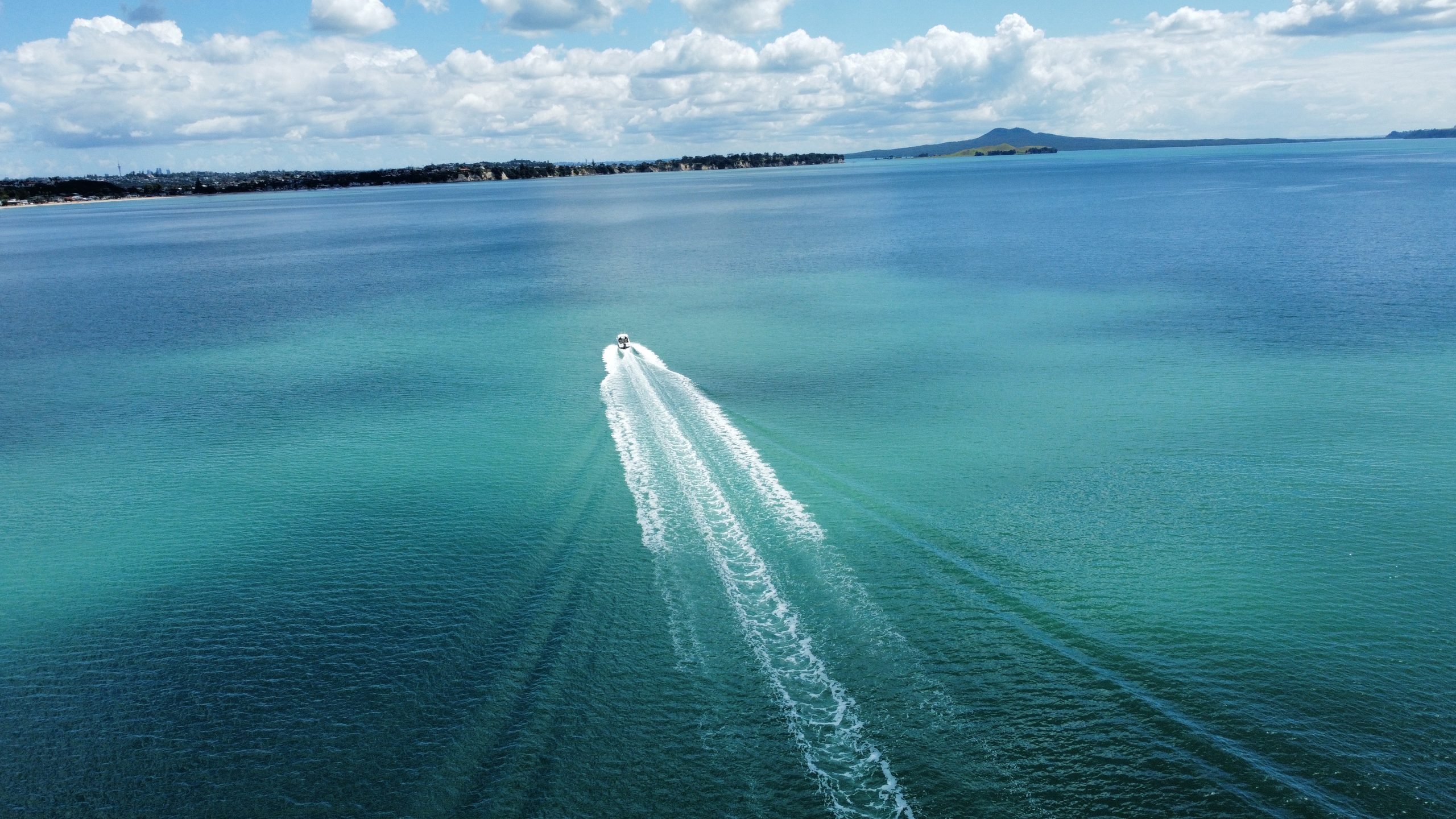
Planning note: distances and motoring times are approximate and assume an average of 20 knots. They vary with the boat, load, sea state and wind. Always check charts, the MetService marine forecast, tide times and local notices, including the High Protection Area rules and Biosecurity New Zealand's caulerpa rules, before you set out.
Photos (Wikimedia Commons): Tiritiri Matangi wharf by DrewHeath, CC BY-SA 3.0; Tiritiri from Shakespear by itravelNZ, CC BY 2.0; lighthouse by Avenue, CC BY-SA 3.0; takahē by Geoff McKay, CC BY 2.0.
Daily members boat from Westhaven, Pine Harbour and Gulf Harbour on fully maintained Buccaneer 635 HTs, without the cost of owning one. Plans from $470 a month.